LiDAR Survey in High Mountain Areas
CONTACTO LiDAR Survey in High Mountain Areas Líbano, Tolima We conducted a LiDAR survey of 800 hectares in the municipality of Líbano, Tolima, a region
CONTACTO LiDAR Survey in High Mountain Areas Líbano, Tolima We conducted a LiDAR survey of 800 hectares in the municipality of Líbano, Tolima, a region

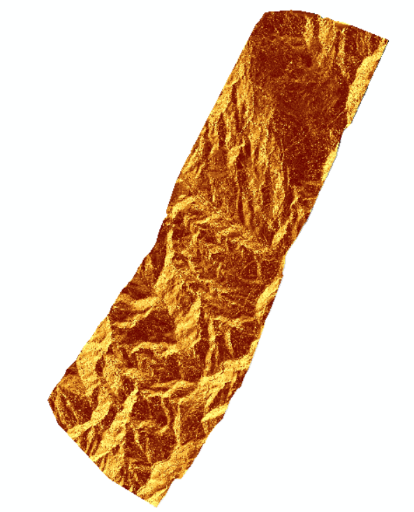
CONTACTO Deformation Measurement in Unstable Sites with LiDAR Technology Ituango, Antioquia. We implemented a LiDAR monitoring system on the road to the municipality of Ituango,
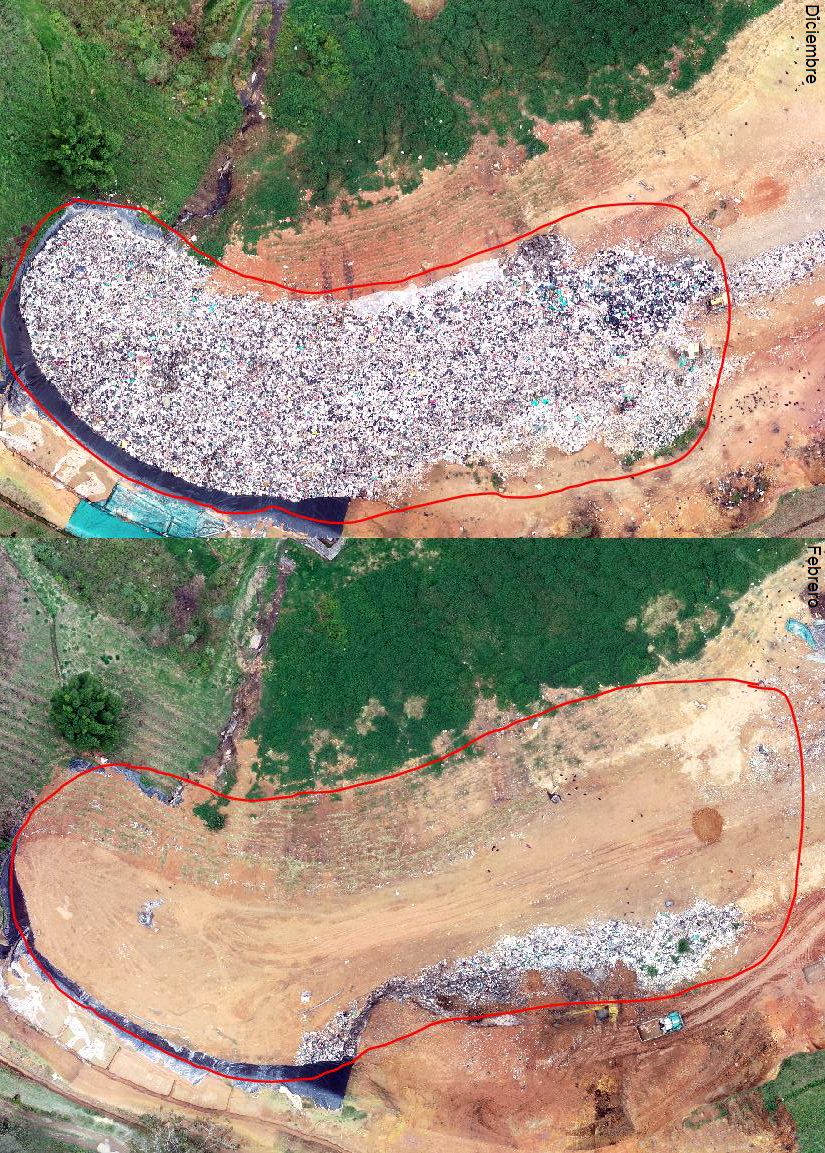
CONTACTO Volumetric Monitoring Los Saltos Landfill We conducted a photogrammetric survey using a drone in nine active mining pits at the El Cerrejón mine in
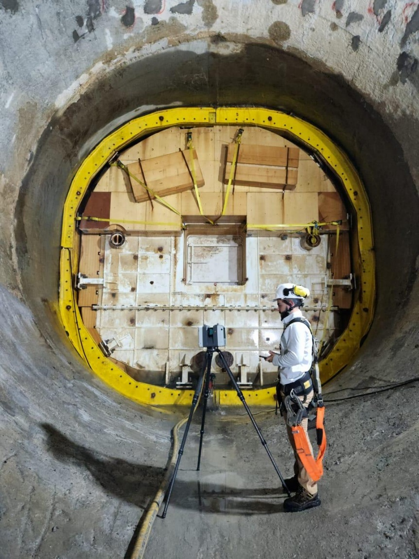
CONTACTO LiDAR Scanning in Conduction Tunnels Ituango Hydroelectric Project We carried out a LiDAR scan of conduction tunnels 2, 3, and 4 of the Ituango
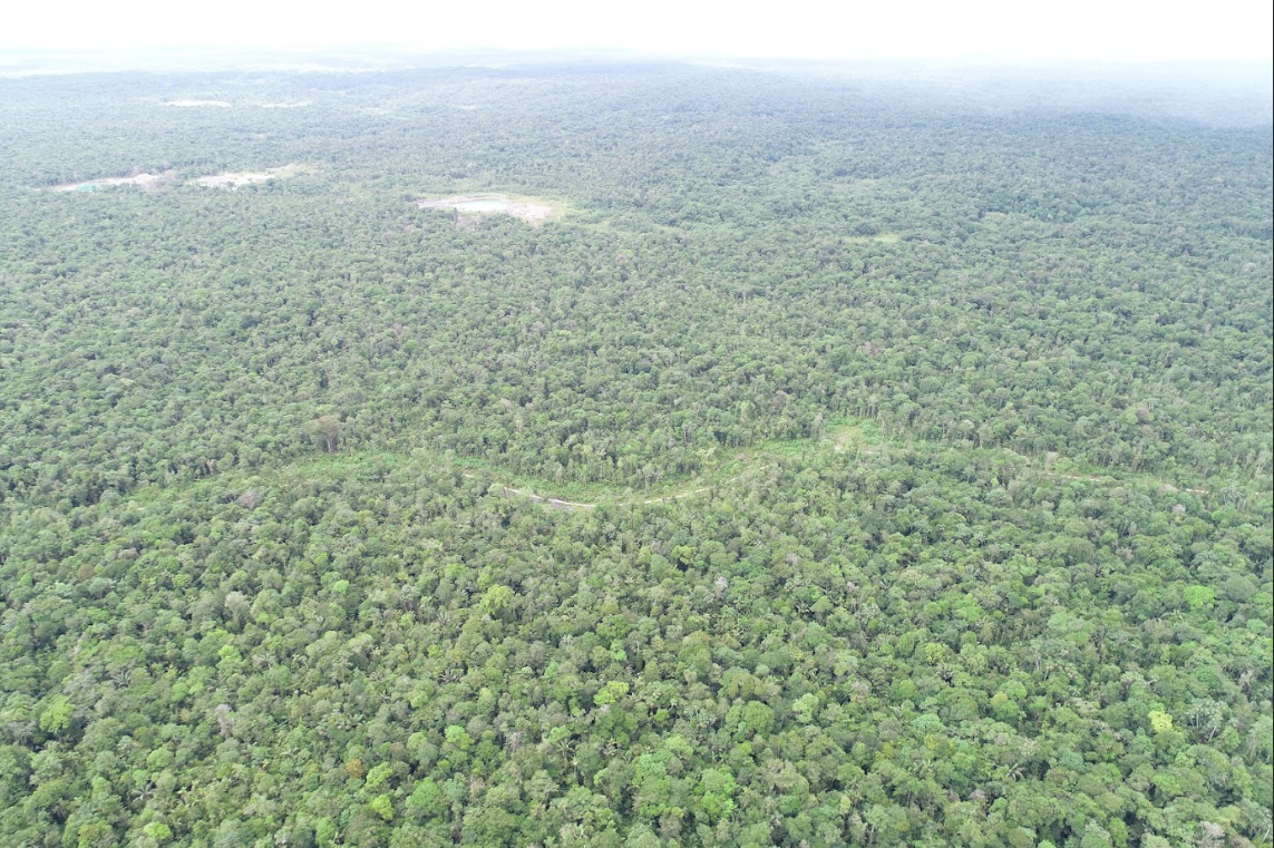
CONTACTO LiDAR Survey in Dense Vegetation Areas Chocó We implemented LiDAR technology in the municipality of Unión Panamericana, Chocó, to identify water accumulation zones in
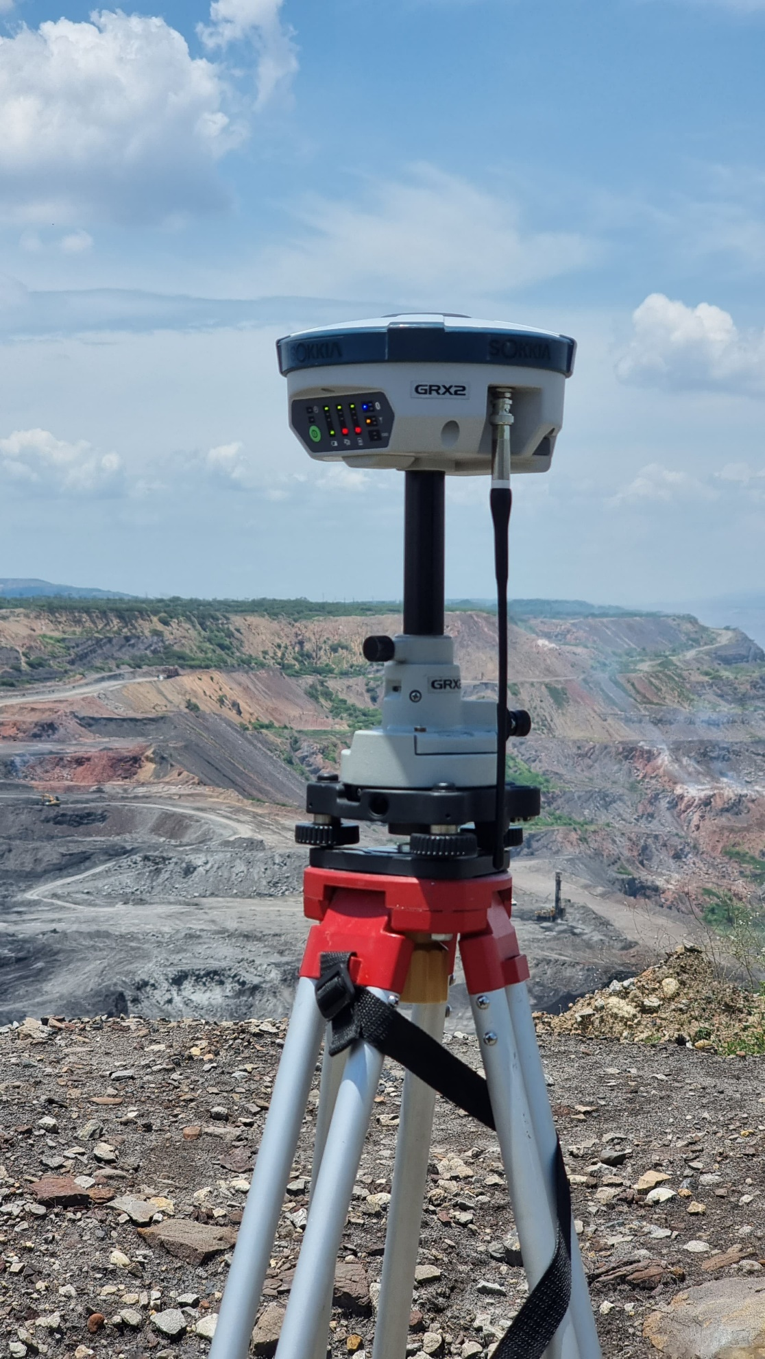
CONTACTO Photogrammetric Survey and Geological Analysis El Cerrejón Coal Mine We conducted a photogrammetric survey using a drone in nine active mining pits at the
CONTACTO CONTACTO 45+ Served Clients 200+ Developed Projects 7+ Years of Experience APPLICATION AREAS CARTOGRAPHY AND CADASTRE GEOLOGICAL RISK MANAGEMENT GEOGRAPHIC INFORMATION SYSTEMS ENGINEERING, GEOSCIENCES,
Titulo del proyecto. Descripcion con mucha informacion del proyecto, aqui puedes ver todos los detalles sobre el proyecto desarrollador como la ubicacio, dispositivos, etc… Es
DRONEARTH SAS. Purpose To create shared value by providing innovative, disruptive solutions that mitigate risks and enhance efficiency through technology. We operate with responsibility and

En un mundo en constante transformación, donde los fenómenos naturales se intensifican y las poblaciones se ven cada vez más afectadas, la prevención de desastres