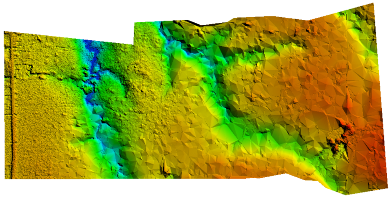
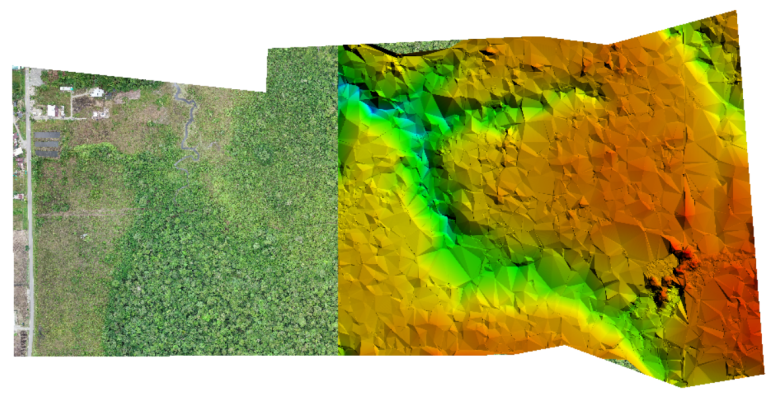
We implemented LiDAR technology in the municipality of Unión Panamericana, Chocó, to identify water accumulation zones in areas with dense vegetation cover. This 70-hectare survey allowed us to generate high-precision elevation models, facilitating territorial planning in hard-to-access areas.